Michinoku Coastal Trail, Up North Adventure into Iwate

  • Guided
  • Tanohata / Yamada
  • 9 Days / 8 Nights
  • ★★★★☆
  • ★★★☆☆

Michinoku Coastal Trail, Up North Adventure into Iwate

9 Days

This tour takes participants to various locations across Iwate, which was once considered to be the ‘ideal land’ by the Samurai who settled there.

Overview

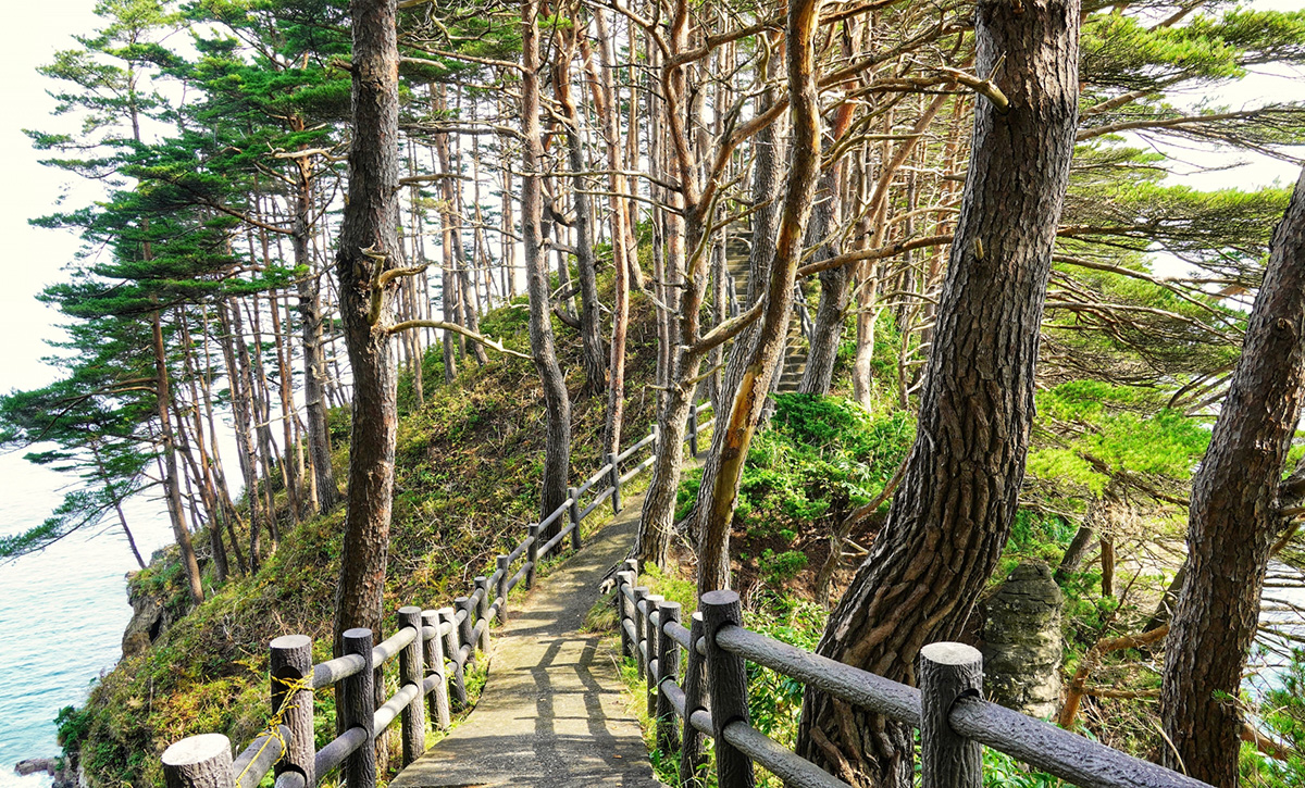
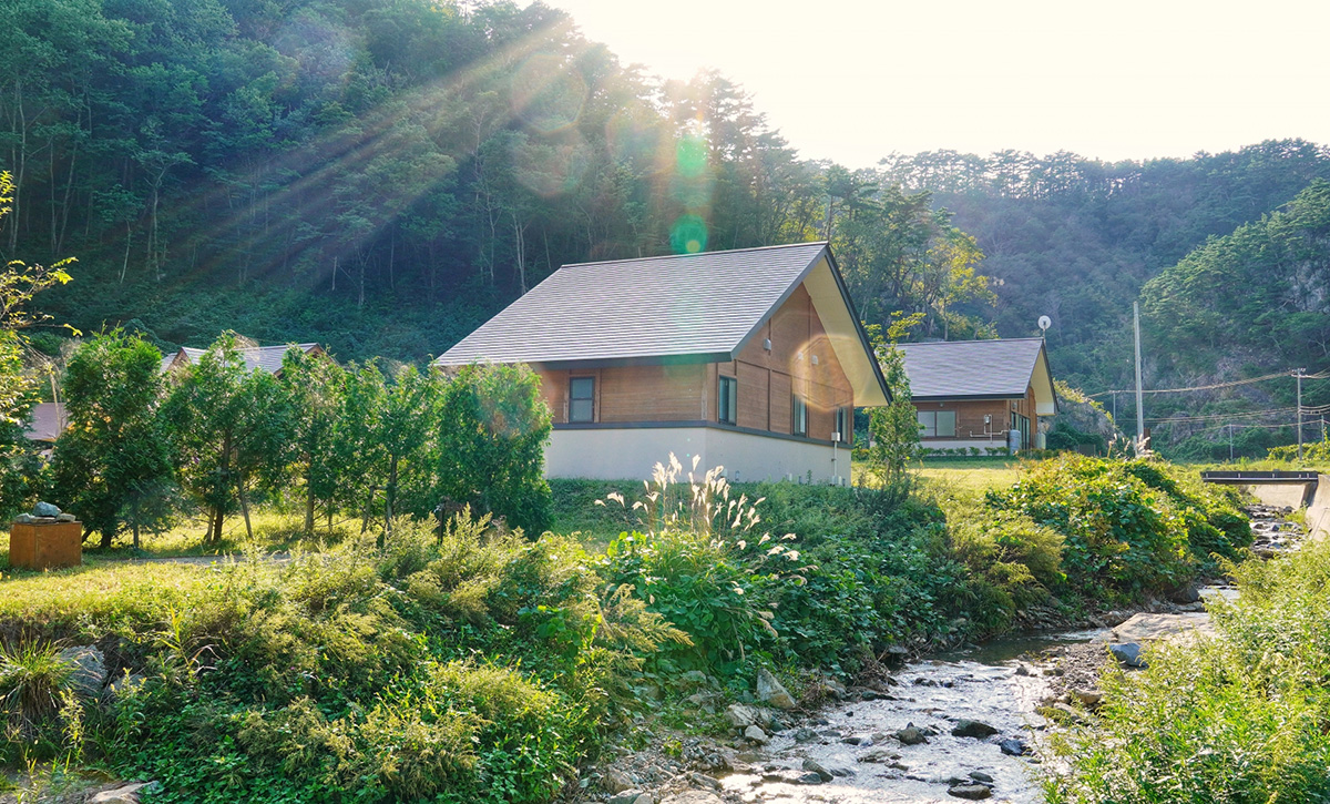
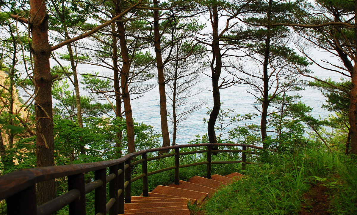
Heartland Japan’s “Michinoku Trail” tour is a guided hiking along the coast of Iwate Prefecture in the North of Japan, which terribly suffered from the tsunami in 2011. In this journey we will guide you in the Michinoku Shiokaze Coastal Trail and you will walk along the Sanriku Coast, to enjoy the eastern side of Japan’s northern Tohoku area and its breathtaking views, cliffs and beaches.

This 9-day tour starts at the stunning Anmoura Viewpoint but the starting point can be changed to the Iwate Hanamaki airport, depending on the arrival time. We are also able to arrange a private car, if for any reason a participant can’t continue with the hike.

The hike is suitable for those who can walk for many hours (from 6 to 10) without distress. The route is not harsh, but the long hours and the daily length covered by this hiking tour require to be physically trained.

Attention: A local guide will lead the group during the hiking, but in any case, we ask to the participants to always exercise caution.
Some parts of the Michinoku Coastal Trail lack pavements for pedestrians, or have roads with heavy traffic. When walking on the trail, please follow the traffic rules and pay careful attention in order to prevent accidents. On roads without pavements, pedestrians should walk on the right side of the road.

Highlights

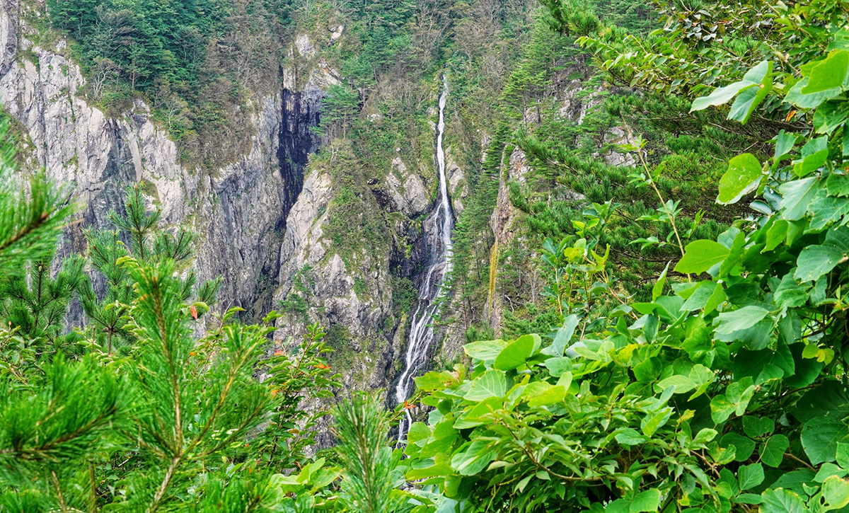
  • Anoumura Viewpoint - from here, you can look down at Anmoura Falls, the tallest waterfall in Iwate Prefecture.
  • Aketo Seawall Memorial - this broken seawall was left as it was so that people will not forget the danger of Tsunami.
  • Place of Origin for Sanhei Uprising - the local population of this area revolted twice in 1847 against a hefty temporary tax.
  • Moshi-ryu Fossil Site - Site of Japan’s first dinosaur fossil.
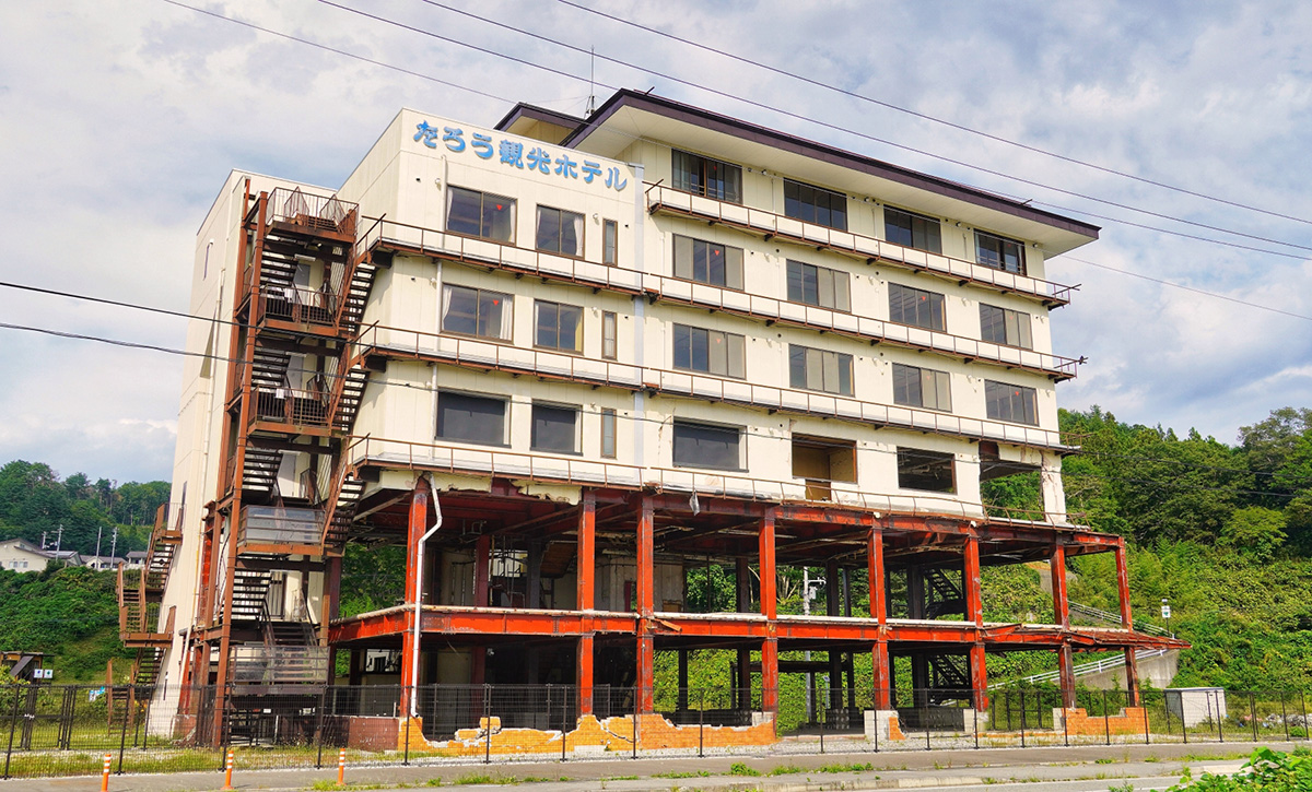
  • Tsunami Monument “Taro Kanko Hotel” - this hotel was destroyed by a 17 meter high Tsunami, and its ruins became a monument.
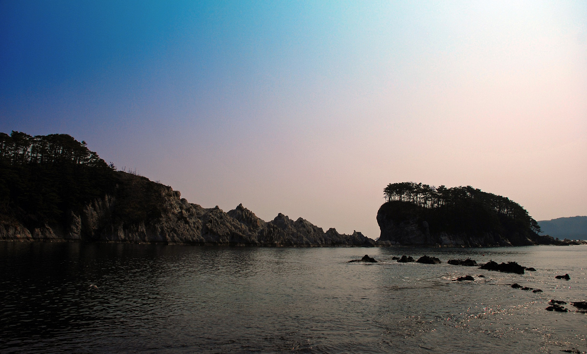
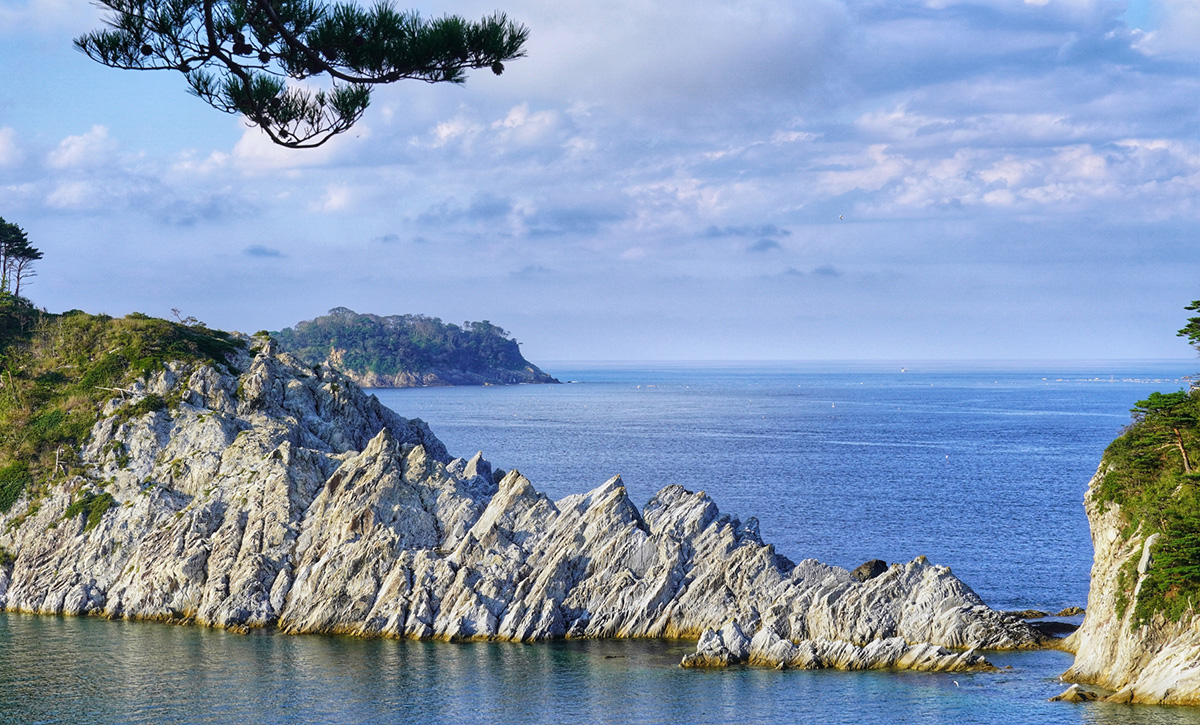
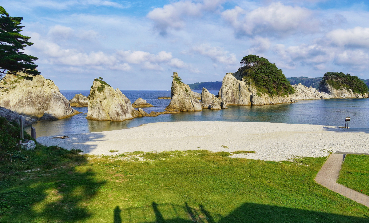
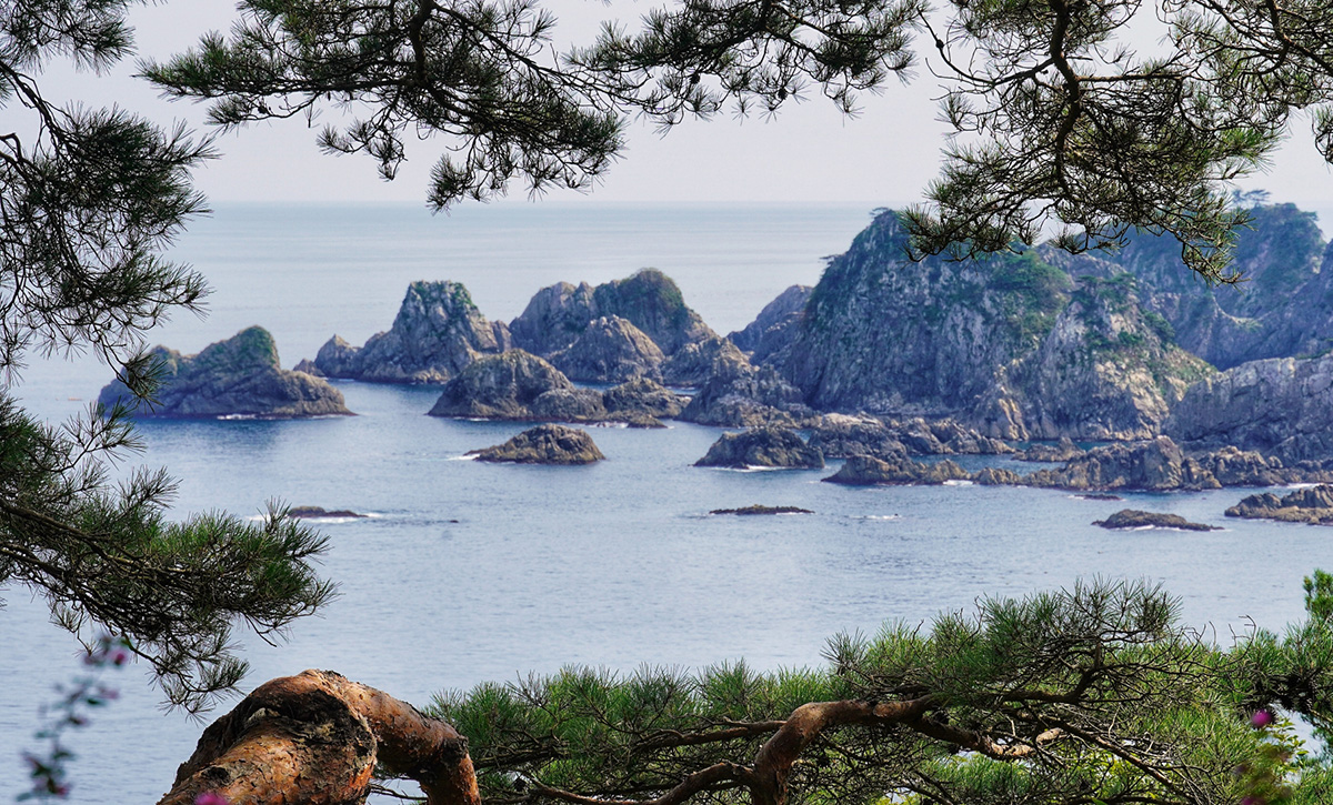
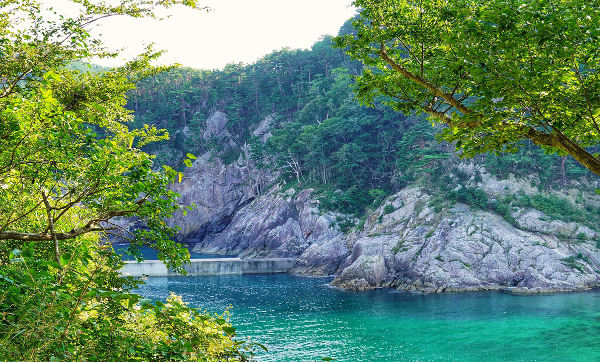
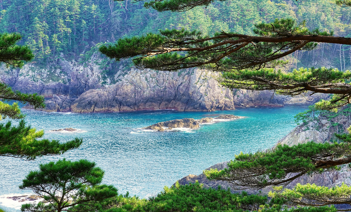
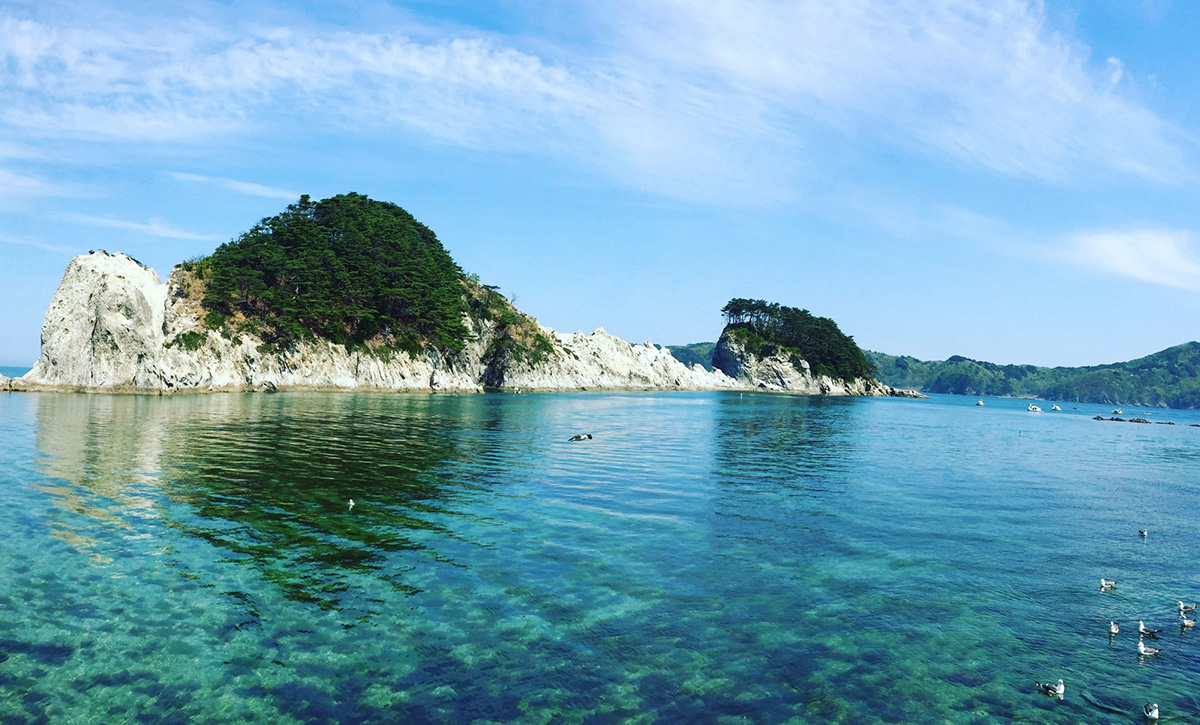
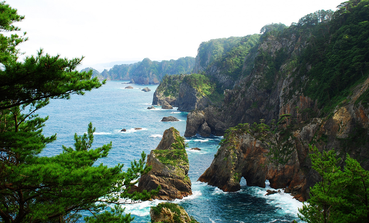
  • Uiso - the contrast between the black of the rock and huge cliffs, the blue of the ocean, the white of the waves and the dark green of the pines make this a famous location.
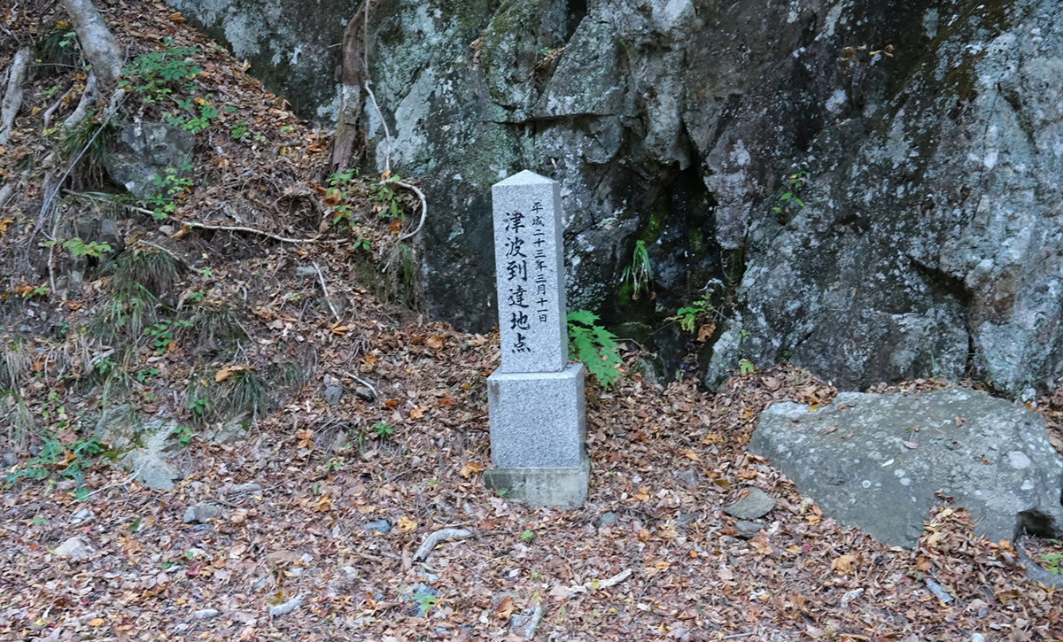
  • Aneyoshi Stone Tsunami Monument - The Aneyoshi area of Miyako suffered serious damage in the past due to Tsunami. The 2011 Tsunami reached over 40 meters at this point. According to a stone monument in the village, there were only two survivors from the 1896 Tsunami, and four survivors of the 1933 Tsunami: this village was destroyed every time a major tsunami struck.
  • Aragami Swimming Beach - this spot boasts impressive scenery of bright sand and clear blue water, along with a shrine (Ara-Jinja) with unclear origins.

Itinerary

Anoumura Viewpoint – from here, you can look down at Anmoura Falls, the tallest waterfall in Iwate Prefecture
Kitayamazaki Viewpoint – Kitayamazaki is known as “Alps of the Sea” by the locals and in the glow of the morning sun is one of the best views in Japan
Manually-dug Tunnel – this tunnel is one of the gems of this trail, but don’t forget to bring a torch
Aketo Seawall Memorial – this broken seawall was left as it was so that people will not forget the danger of Tsunami

Haipe Koikorobe Coast – the name for this small peninsula comes from the Ainu language, and the area is known for producing many Cretaceous Period fossils Place of Origin for Sanhei Uprising – the local population of this area revolted twice in 1847 against a hefty temporary tax. Unosu Cliff – the sheer height of this cliff can only truly be understood by looking down from it

Kuma no Hana Viewpoint – from this viewpoint, you can see a peninsula which looks like a bear’s nose.
Moshi-ryu Fossil Site – Site of Japan’s first dinosaur fossil.
Moshi Coast – The rocks here show different layers from the active volcanic period.
Setta Tsunami Rock – A tall rock brought by the 1896 Tsunami.
Taro Temporary Shopping District – Named “Taro-chan House”, this is a shopping complex made for those who lost their houses due to the 2011 Tsunami.

Masaki  Viewpoint – from this viewpoint, you can look out far over Miyako’s coastline
Sanno Park, Sannoiwa Rocks – one of the rocks in this park resembles a Japanese taiko drum
Tsunami Monument “Taro Kanko Hotel” – this hotel was destroyed by a 17 meter high Tsunami, and its ruins became a monument.

Sagabe – white granite cliff and reef
Tochinai Beach – this beach has no handmade structures
Tsunami Memorial Park Nakanohama and Miyako-Anegasaki Campground – emergency facilities available
Anegasaki Viewpoint – take in the tunnels and caves
Shiofukiana – home to a 2.5 metre tall blowhole, connected to a cave eroded by the sea
Himeshima Island – when viewed from nearby villages, this is the area from which the sun rises
Jodogahama Beach – this white gravel beach has sharply pointed white rhyolite rocks grouped together. It’s a great location for swimming and kayaking.
Ryujinzaki Viewpoint – this cape provides a great panoramic view of the Miyako area

Gassan Viewpoint – From the observation platform at the top of Mt Gassan you can see across the Miyako Bay, coastline and cliff
Uiso – the contrast between the black of the rock and huge cliffs, the blue of the ocean, the white of the waves and the dark green of the pines make this a famous location

Tanesashi Beach – you can walk through a forest of giant Japanese red pines and Mongolian oak along the coastline. This coast was famous for its flowers, which were unfortunately destroyed by the 2011 Tsunami.
Cape Todogasaki and Todogasaki Lighthouse – this is the easternmost point of Japan’s main island of Honshu.
Aneyoshi Stone Tsunami Monument – The Aneyoshi area of Miyako suffered serious damage in the past due to Tsunami. The 2011 Tsunami reached over 40 meters at this point. According to a stone monument in the village, there were only two survivors from the 1896 Tsunami, and four survivors of the 1933 Tsunami: this village was destroyed every time a major tsunami struck.

Old Village Mountain Pass Road – this hard-to-walk pass was used before a street was constructed just 50 years ago
Osawa Reclining Dragon Plums – plum trees with a trunk reclining sideways and growing horizontally
Nanyo-ji Temple Stone – in front of the gate to Nanyo-ji Temple, there is a stone monument dedicated to sharing knowledge of the 1933 Showa Tsunami
Yamada Bay – here visitors have the chance to enjoy kayaking and have a BBQ on Oshima (Holland Island)

This route can be customised
It is possible to choose between a 14 km route starting in Michi no Eki and ending in Sukuiso-guchi (arrows in the map) or starting from Shuzendo Temple and walk for about 15 km until Koyadori-guchi Entrance (dots in the map).
There are no accommodations along these routes, so a car will be available from the ending point to a different place for the night. Along the car route there is a lovely beach for swimming:
Aragami Swimming Beachthis spot boasts impressive scenery of bright sand and clear blue water, along with a shrine (Ara-Jinja) with unclear origins.

The Yamada Matsuri will be held from September 19th to the 21st, having previously been suspended for more than three years as a result of Tsunami damage.
This festival provides a fantastic opportunity to feel the love of the Yamada people for their hometown.

This itinerary is subject to change

Write a Review

Your email address will not be published. Required fields are marked *

Personal Information

Price

¥594,000

Need help with booking?

From ¥594,000
/ Adult
April 2024
M T W T F S S
1234567
891011121314
15161718192021
22232425262728
2930  

Scroll to Top
Contact Us