
One of Kyoto’s best features are the mountains that ring the city on three sides. These mountains were one of the primary reasons why in 794 Emperor Kammu chose the basin between to be his new capital, Heian-kyo. According to ancient Chinese principles of feng shui, the hills surrounding the city would help protect it, and the break in the hills to the south was proper as that direction is the usual orientation of not only imperial thrones, but for the altars for the burgeoning religion of Buddhism.
While the hills to the west appear quite far away, and the Kitayama peaks to the north looming large and imposing (though lined with numerous hiking possibilities), it is the proximal Higashiyama range to the east that seems part of the city itself, both geographically and culturally. The mountains of Higashiyama came to be collectively known as the Higashiyama Sanju-Roppo or Higashiyama Thirty-Six Peaks, which does not necessarily refer to thirty-six individual peaks, but rather to the idea that the gently sloping mountains of Higashiyama appear to be connected in a row when viewed from the center of the city. These peaks were the subject of poetry from the earliest times, but by the later Edō period were considered one of Kyoto’s top scenic spots.
While the peaks on this eminent list changed over time, they were not definitively fixed until 1984, though they were always bookended by Inariyama and Hieizan. There is some debate whether the lofty 800 meter heights of that latter peak should even be included on the list. If disqualified, the eye is naturally draw to the sharp rise of 472 meter Mt. Daimonji to its south. This peak’s name is a bit of a misnomer, as it is a feature of what should rightly be called Nyoi-ga-take, take referring to a conspicuous part of a mountain ridge. Although slightly lower at 464 meters, the prominence of the better known name of Daimonji just in front inevitably brings out a person’s innate desire to climb.
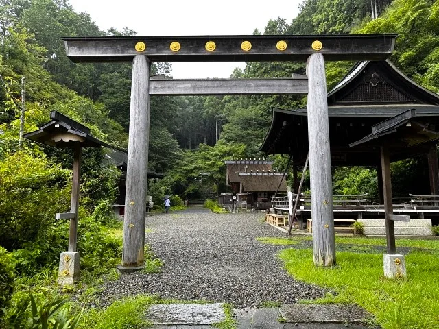
Japan confuses the visitor in its (seemingly) religious split between Buddhism and Shinto. It seems fitting then that the hiker can choose between starting their hike at the zen monastic collective of Nanzen-ji, or at the Himukai Jinja shrine just around the corner. In either case, the hike will begin at Keage Station.
For the shrine, you’ll follow what was formerly the Tokaidō post road uphill out of the station, then take the set of steps that leads past a massive set of brick irrigation works dating to the Meiji Period. After the Meiji Emperor moved the capital to his new city of Tokyo, the city of Kyoto began to suffer a decline in commercial activity and in population. The governor of Kyoto prefecture called for the construction of a canal to provide irrigation and facilitate the transport of good from neighboring Lake Biwa. The canal was finished in 1890, based on the graduation thesis of a student at the Imperial College of Engineering, and served as Japan’s first major public works project independent of oversight by foreign advisers.
The quiet suburban lane begins to climb until reaching the shrine itself. The name Himukai means to face the sun, and is oriented toward the grand Ise Shrines far to the south, and the major deity of both shrines, the Sun Goddess Amaterasu. Like the Ise Shrines it faces, there is a division here between inner and outer shrine, on a much smaller scale of course, but with similar thatch roofs whose gables resemble the rolls of bonito that once served as offerings in ancient times. Legend has it that Amaterasu hid in a cave after her brother defiled her palace, and there has been great debate about where that cave might be. The hiker will pass a miniature version of the cave, which is well worth passing through before carrying on along the trail as it hugs the hillside, eventually climbing to a pass that marks the ridgeline.
Keage station also marks the start of the Nanzen-ji course, which passes beneath a brick arch of the irrigation canal, and leads you through through a series of subtemples before arriving at the impressively massive wooden gate leading to the main hall.
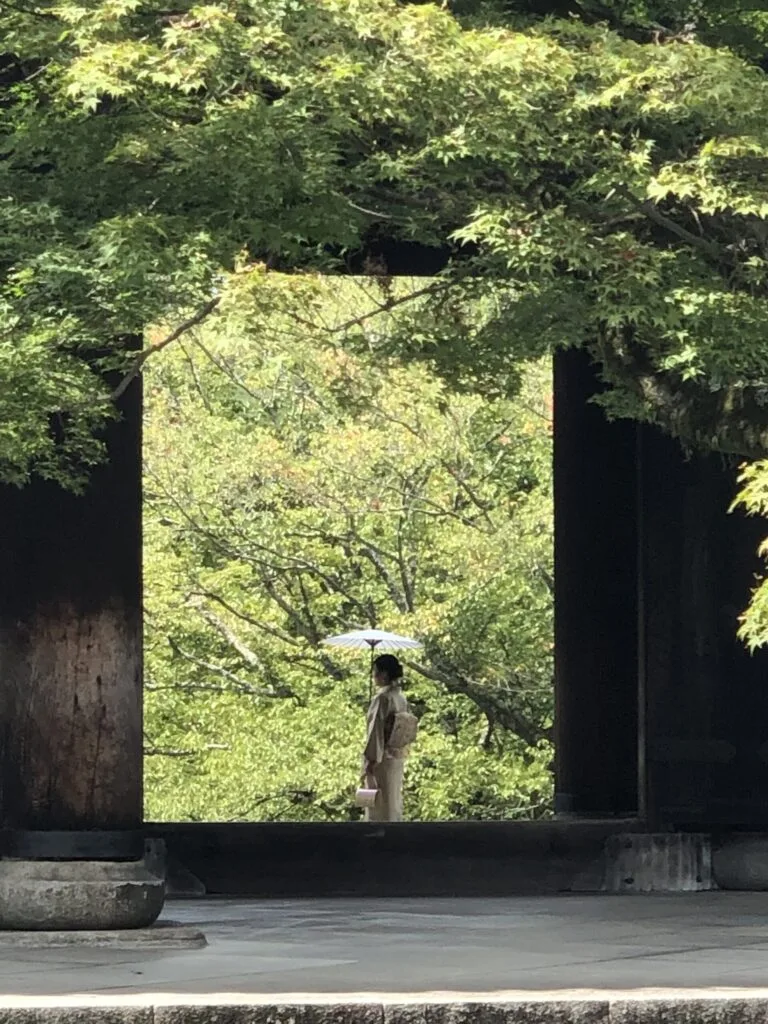
Kyoto’s zen temples have always been grouped in five, their rank constantly changing, but Nanzen-ji stands separate and ranked above them. The temple’s roots date to 1291, but the buildings we see were built only in 1909, after one of the many numerous fires to plague the temple complex over the centuries. In fact, the brick aqueduct is older, and it is in that direction the hiker will head, passing beneath before beginning the climb up towards the ridge.
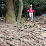
It is well worth stopping in at Saishō-in temple just beyond, for its tidy little garden (and mysterious English poem, about which I can find no information whatsoever). The paved path brings you eventually to a small waterfall used by monks for aesthetic practice, though the visitor is asked to refrain from taking a quick dip. The path continues past some steps that lead to a pair of cave altars above, then climbs alongside a stream before leveling out. The main route up to the pass will appear to the right, but continuing straight you’ll soon find a junction with a trail on the left, which leads to a small cemetery related to Doshisha, Japan’s first Christian university. The first good view of the city is just in front. The hiker could call it a day here and follow the path in front back down to the city, but to follow the entire traverse, return to the junction. Turning right brings you soon back to the primary and relatively gentler ascent to the ridge, while turning left will eventually lead you upward though on a lesser known path that is steeper and more severe. In either case, in arriving at the ridgeline, one meets the aforementioned path up from Himukai Jinja.
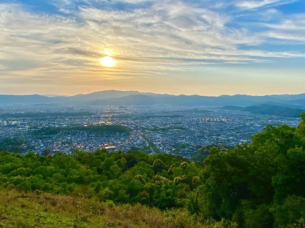
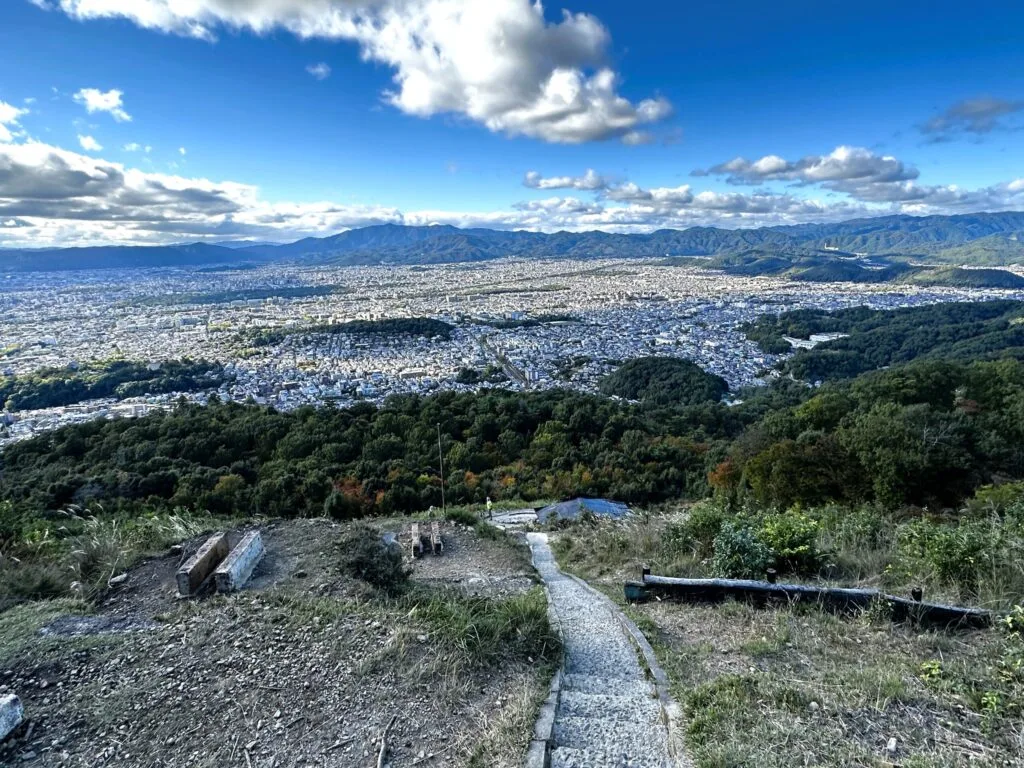
It is a relatively gentle walk along the gradually rising ridgeline, with a few smaller trails dropping back to the city to the left, and the occasional view of Yamashina opening to the right. You’ll be at the peak of Daimonji within the hour, which offers terrific views over south Kyoto, including Mt. Fushimi and Mt. Daigo. The Ikoma range will be out further still, along with the skyline of Osaka far in the distance. The aforementioned, slightly higher Nyoi-ga-take, is just behind you. It goes without saying that this is a terrific lunch spot.
The path drops sharply from here. The gravity-heavy rush of rainwater has doubled and tripled the trail in places, but like those waters, they eventually rejoin the main flow of trail again and again. There are faint vestiges of the berms that shaped the moat of Nyoi Castle which was built here in 1549, atop an earlier version dating from a century earlier. A temple with the same name stood here from 938, but no real traces remain. The name Nyoi is thought to mean, “All is splendid with the world,” the legendary first words of Amaterasu as she was enticed from her cave.
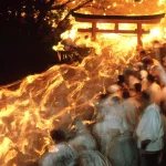
You’ll pop out of the forest at the very top of the character for Dai, which gives Daimonji its name. This character is the first of the five okuribi fires burned on August 15, serving not only as a traditional Obon farewell rite, but as a prayer for peace in the capital, for the safety and good health of the household, and as a means of scaring away evil spirits. The origins of the festival are obscure, but legendarily a glow was seen midway up the hill, emanating from a statue of Amida that had been stolen from Jōdo-in temple below. Wood for the fires is cut every year in February, dried from April to May of the following year, then brought down to the foot of the mountain and stored in various households, altogether 600 bundles of red pine, 100 bundles of pine needles, and 100 bundles of straw, totalling 25 trees.
The shape of Dai character is actually formed by the concrete steps that you will descend to the city. I’ve oriented the hike in this direction so that you have the entirety of Kyoto laid out below with every step. The braziers for the fires are just beside the trail, which too would make for good picnic spots, but beware the kites who will swoop down to steal food from the hands of the unsuspecting. The small altar built into the hillside at the center of the character is allegedly where the stolen Amida statue was found.
A number of trails lead from here off the mountain, but we’ll trace the leg of the Dai character leading down to our right, which will deposit us into forest again, for a gentle descent to a forest road paralleling a stream. A few hard to spot trails lead up to a network of smaller paths north of Daimonji, little known but by the locals. A golf course had been proposed to be built atop them, but luckily cooler heads called for the project to be cancelled a few years later. You’ll spot a water source part way down, above a Korean school just out of sight in the trees above.
It will be obvious by the crowds that you have arrived at the gates of the Ginkaku-ji silver pavilion, well worth a quick detour.
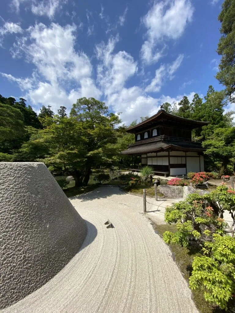
The lovely grounds were once the retreat of shogun Ashikaga Yoshimasa, built in 1482 as an homage to the Golden Pavilion of his grandfather across town. The shogun is much criticized for using it as a hideaway, as Kyoto began to burn in the Ōnin War that raged for a full decade. The violence eventually spread throughout the rest of Japan over the next century and a half. Thankfully for us, the patronage of this Japanese Nero gave birth to many of the Japanese cultural forms we still have today: tea ceremony, flower arrangement, Noh theater, and ink painting, known collectively as Higashiyama culture. The architecture of the temple buildings evolved into the shoin style of room design, with its familiar pattern of tatami mats, and tokonoma alcove for displaying art.
Exiting the temple again, you could turn left to rejoin the path you’d been on, which will bring you through quiet suburb to a handful of smaller temples hugging the base of the mountains. Continuing straight instead drops you down an old shopping street that historically sold Buddhist items to pilgrims visiting the temple above. Today many instead sell coffee, ice cream, and local sweets. You could consider a stop for a beer at the bottom of the hill, before turning left to follow the stream along the Path of Philosophy, named for Nishida Kitaro, a famous philosophy professor at Kyoto University who was often seen walking this route deep in thought.
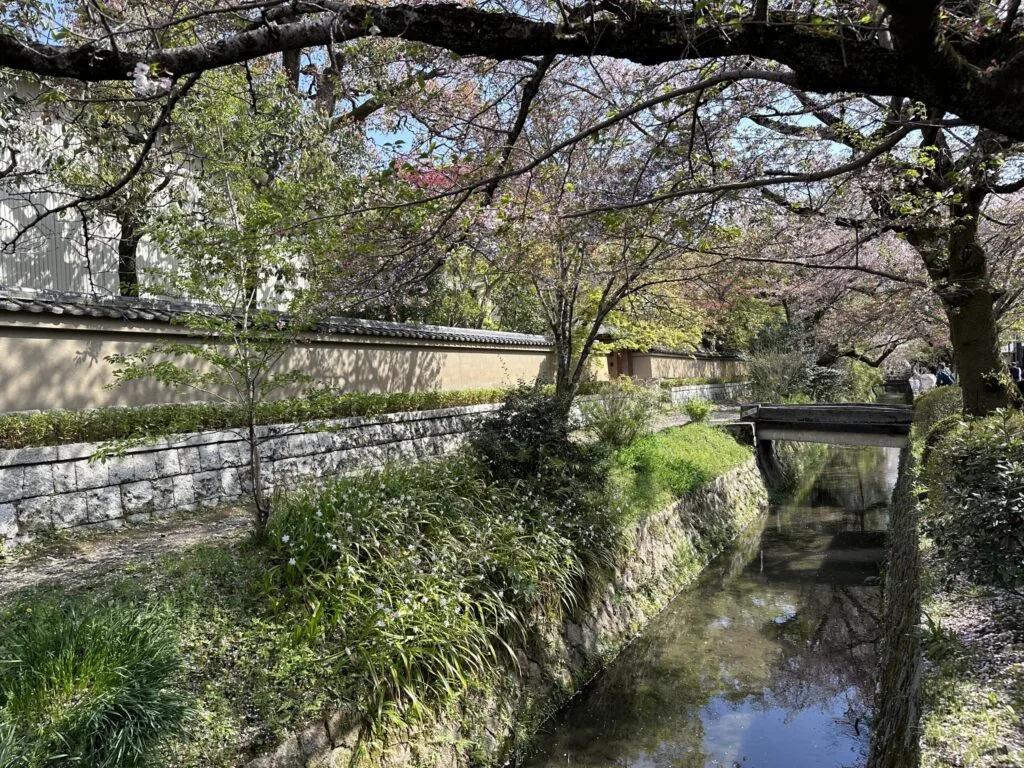
Today the walk hosts quaint shops and cafes, slowly swimming carp, the swell of cherry blossoms in season. It take about 30 minutes to meander along the pleasant path to its terminus just above Eikandō, a temple at its best during the colored maples of autumn. Wrapping around the front of the temple, the walker soon reenters Nanzen-ji from the side gate. There are a number of temple gardens worth visiting, but those ready to call it a day can retrace their steps along the small lane that leads back to the subway at Keage